
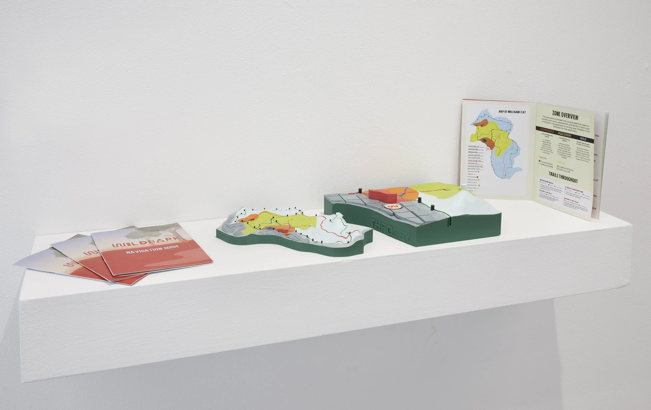
Jake Haynes, Tom Entwistle, Charley Barnes, Mapping Wildbark, 2025, 3D printed PLA, paper booklet, Client - Wildbark (Jason Cummings).
Photographer: Brenton McGeachie
Mapping Wildbark
Client:
Jason Cummings, Wildbark
Charley Barnes Bachelor of Design and Bachelor of Visual Arts
Tom Entwistle Bachelor of Design and Bachelor of Science
Jake Haynes Bachelor of Design
This project presents an interactive topographic map of Wildbark, created to help orient visitors helping them to understand their position within Mulligans Flat Woodland Sanctuary and its surrounding urban context. The 3D printed and hand painted topographic model captures the sanctuary’s terrain, highlighting key trails, landmarks, access points and the protective fence perimeter that defines its boundary. Surrounding urban infrastructure is included to emphasise the contrast between the conserved woodland and Canberra’s expanding edge, reinforcing the importance of its preservation. Accompanying the map is a navigation guide booklet that expands on the features represented, offering historical and ecological insights that deepen visitor understanding. Together, the map and booklet translate complex spatial, environmental and historical information into a tactile, accessible and visually engaging form that invites audiences to explore how conservation, geography and community coexist at the edge of the city.